
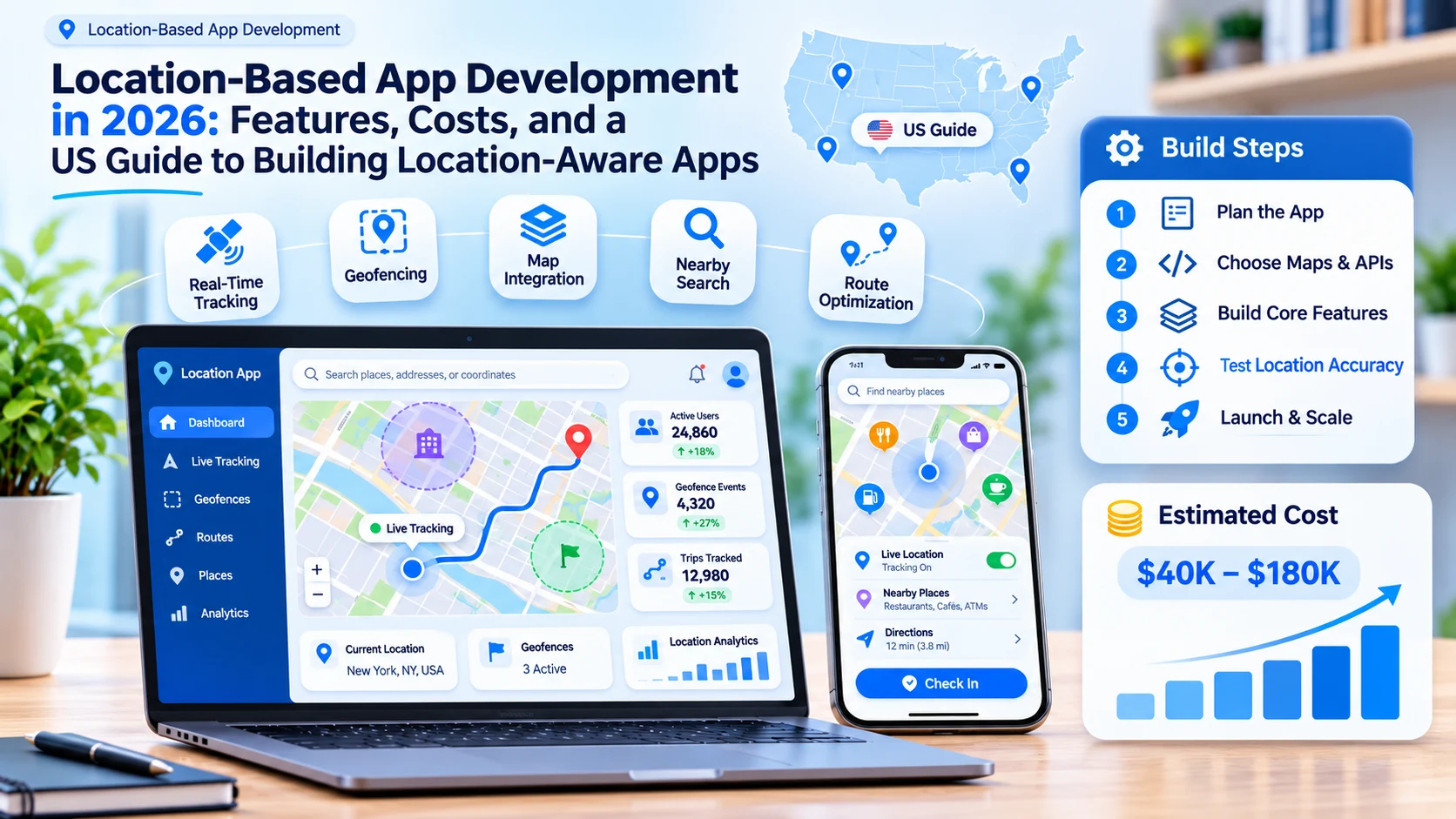

Open almost any popular app on an American phone and location is quietly doing the heavy lifting. It finds the closest store, estimates when a driver will arrive, unlocks an offer at the right moment, and confirms that a technician actually reached the job site. That is why location-based app development has become a priority for US businesses: location based apps turn a customer's physical context into faster service, more relevant offers, and better operational data.
Building one well takes more than dropping a map onto a screen, though. Strong location based mobile apps balance accuracy against battery life, ask for no more location access than they need, keep mapping costs under control as usage grows, and follow a fast-changing set of US privacy rules for precise geolocation.
This guide walks through everything you need to plan location-based app development in 2026, using the same approach we apply in our mobile application development projects for US companies. You will learn how the technology works, which features matter most, how to choose mapping tools, what US compliance requires, and what to budget.
Quick answer: Location-based app development is the process of building mobile and web apps that use a device's position, from GPS, Wi-Fi, cell towers, or Bluetooth beacons, to power maps, nearby search, real-time tracking, geofenced alerts, and location analytics. A focused US MVP typically costs $30,000 to $60,000 and takes 3 to 4 months, while real-time tracking platforms cost more.
What Is Location-Based App Development?
Location-based app development is the design and engineering of software that uses where a person or device is to decide what to show or do next. These products are often called location based services apps, or LBS apps for short.
You will also hear the term location-aware application. The two overlap, but there is a useful difference. A location-based app is built around location as its core job, such as a delivery tracker or a navigation app. A location-aware app uses location as helpful context, such as a retail app that shows local store hours or a news app that highlights local stories. Both need the same careful handling of permissions, accuracy, and privacy.
Under the hood, most location-based software has five layers:
| Layer | What it does | Typical building blocks |
|---|---|---|
| Positioning | Works out where the device is | GPS and other satellite systems, Wi-Fi, cell towers, Bluetooth beacons, ultra-wideband |
| Maps and geodata | Displays places and converts addresses into map coordinates | Map SDKs, geocoding, place search, routing |
| App logic | Decides what to do with a location | Nearby search, geofence triggers, arrival estimates |
| Backend and analytics | Stores, queries, and analyzes location data | Spatial databases, real-time data streams, dashboards |
| Privacy and consent | Controls what is collected, kept, and shared | Permission prompts, consent records, retention rules |
Most projects also include a browser-based side, such as dispatch consoles, store locator widgets, admin portals, and analytics dashboards. That is why custom web app development usually runs alongside the mobile build rather than after it.
Why US Businesses Are Investing in Location-Based Apps
The market keeps growing. Mordor Intelligence estimates the US location-based services market at $27.33 billion in 2026 and projects it to reach $54.32 billion by 2031, a compound annual growth rate of about 14.7%. The firm expects indoor positioning (about 20.5% a year) and location-based advertising (about 23.6% a year) to grow fastest, and it found that business intelligence and analytics accounted for about 29% of the market in 2025. Estimates vary between research firms, but every major forecast points to growth.
Customers expect location-smart experiences. Live driver tracking, "near me" search, and curbside pickup alerts are now everyday expectations rather than premium extras.
Operations run leaner. Real-time tracking, smarter dispatch, and automatic proof of visit cut wasted miles, missed appointments, and "where are you?" phone calls.
Local marketing gets sharper. Geofenced offers and location-verified promotions help businesses reach people who can actually walk through the door.
Location data improves decisions. Aggregated visit patterns, trade areas, and demand heatmaps help teams choose new sites, schedule staff, and plan inventory.
How Location-Based Apps Find a User's Location
Phones combine several signals to estimate position, and each one has strengths and trade-offs:
| Technology | How precise it is | Best for | Trade-offs |
|---|---|---|---|
| GPS and other satellite systems | About 4.9 meters (16 feet) under open sky, according to GPS.gov | Outdoor navigation, live tracking, fitness | Uses more battery and weakens near tall buildings, bridges, trees, and indoors |
| Wi-Fi positioning | Building to street level, depending on nearby networks | Urban areas and indoor fallback | Needs dense Wi-Fi coverage |
| Cell towers | Neighborhood level | Low-power, rough location | Too coarse for turn-by-turn features |
| IP address | City or region level | Personalizing web content | Not reliable for a precise position |
| Bluetooth beacons | Room or aisle level, indoors | Indoor wayfinding, proximity alerts, in-store experiences | Requires installing and maintaining hardware |
| Ultra-wideband (UWB) | Very precise at short range | Precision finding for smart tags, secure access | Limited device and hardware support |
| Motion sensors | Fills gaps between location fixes | Smoother tracking, step and turn detection | Drifts over time without a fresh fix |
Modern phones blend these sources automatically through Apple's Core Location framework and Android's fused location provider. Your job is to choose the accuracy each feature genuinely needs, because higher accuracy costs battery life and asks users for more trust.
Types of Location-Based Apps
| App type | How location is used | Familiar US examples |
|---|---|---|
| Navigation and maps | Turn-by-turn directions, traffic, and place search | Google Maps, Waze |
| On-demand and delivery | Matching customers with nearby drivers and showing live arrival times | Uber, DoorDash |
| Local discovery | Surfacing nearby restaurants, events, services, and deals | Yelp |
| Store and product locators | Finding the nearest location or a store that carries a specific product | Retailer "find a store" and brand "where to buy" pages |
| Fleet, logistics, and field service | Live vehicle tracking, route planning, and proof of delivery or visit | Delivery fleets, HVAC and pest control teams |
| Safety and family | Location sharing, arrival alerts, and emergency help | Life360 |
| Fitness and outdoors | Recording routes, pace, and elevation | Strava |
| Real estate and travel | Showing listings, attractions, and itineraries near a chosen area | Zillow |
| Location-based games and AR | Blending digital content with real places | Pokémon GO |
| Location-enabled products | Companion apps that show where a physical device is | Apple AirTag with the Find My app |
| Indoor positioning | Wayfinding inside large buildings | Hospitals, airports, stadiums, warehouses |
Location-based discovery deserves a special mention because it is how many people find local businesses. A discovery app ranks nearby options by distance, relevance, and timing, then helps the user act, whether that means booking, ordering, or claiming an offer. Hyperlocal deals platforms are a good example, and we covered their planning pitfalls in Why the US Founders Building a Hyperlocal Local Deals And Promotions App Need a Technology Consultant in 2026 Before Writing a Line of Code.
If your idea matches people with nearby drivers, couriers, or service providers, our on-demand app development services team can help you design the matching, dispatch, and live tracking logic.
Must-Have Features of Location-Based Apps
| Feature | What it does | Why it matters |
|---|---|---|
| Permission and consent flow | Asks for location only when a feature needs it and explains why | Higher opt-in rates and a clear consent record |
| Precise or approximate choice | Keeps working when users share only their approximate location | Respects user choices on iOS and Android and keeps the app usable |
| Current location and map view | Shows the user's position with a visible accuracy circle | Builds trust and sets expectations |
| Address search and autocomplete | Turns typed addresses into map points and back again (geocoding) | Faster checkout, booking, and search |
| Nearby search and filters | Finds places by distance, category, hours, and rating | The core of location-based discovery |
| Store or product locator | Lists the closest locations or the stores that carry a product | Drives foot traffic and in-store sales |
| Real-time tracking and ETA | Streams live positions and predicts arrival times | Fewer "where are you?" calls and support tickets |
| Directions and navigation | Opens Apple Maps or Google Maps, or offers in-app routing | Gets users to the door without friction |
| Geofencing and alerts | Triggers an action when a user enters or leaves an area | Timely reminders, check-ins, and offers |
| Location sharing | Shares live location with chosen people for a set time | Safety and coordination without permanent tracking |
| Offline support | Caches maps and queues updates when the signal drops | Reliable use in rural areas and large buildings |
| Admin dashboard | Manages locations, zones, campaigns, and users | Keeps data accurate without developer help |
| Location analytics | Shows aggregated visits, heatmaps, and trends | Better decisions without exposing individuals |
| Privacy controls | Lets users pause sharing, view history, and delete data | Meets state privacy rights and builds loyalty |
| Accessible map alternatives | Offers a list view and screen reader labels | Supports ADA and WCAG accessibility expectations |
Advanced Features That Set Your App Apart
Indoor positioning and wayfinding. Bluetooth beacons, Wi-Fi, and ultra-wideband can guide people through hospitals, malls, airports, and warehouses, where satellite signals struggle.
Route optimization and smart dispatch. Algorithms assign the nearest available driver or technician and order multi-stop routes to save time and fuel.
AR navigation and overlays. Augmented reality can point the way or place digital information on top of real-world objects.
Predictive ETAs and demand forecasting. Machine learning models learn from past trips, traffic patterns, and seasonality to predict arrival times and forecast demand by neighborhood and hour. Turning those models into dependable product features is AI product development work, not a plug-in you switch on.
Anomaly and spoofing detection. Models can flag unusual stops, route deviations, or signs of a faked GPS signal.
When one of those flags fires, it should land in the dispatcher's or fraud team's existing queue with a clear owner and a documented outcome. Planning that hand-off is where AI integration and adoption matters as much as the model itself.
Location-verified promotions. Some apps confirm that a user is actually in a target market before they can enter a contest or redeem an offer, which keeps local campaigns local.
What Features Should You Look for in a Product Locator App?
A store locator shows where a company's own locations are. A product locator goes a step further and shows which nearby stores carry a specific item, which matters for brands that sell through retailers and distributors. Whether you build one or buy one, look for these capabilities:
- Flexible search. Shoppers should be able to search by ZIP code, city, or current location, then filter by product, size, flavor, or SKU.
- Trustworthy availability data. Pull from retailer feeds, distributor reports, or online availability data, clean up duplicate addresses, and show when each listing was last updated.
- Map and list views together. A list is faster to scan on a phone and easier to use with a screen reader.
- Clear next steps. Include directions, click-to-call, store hours, and links to buy online or reserve for pickup where retailers support it.
- Privacy-light location. Approximate location is usually enough. Google's Play policy guidance notes that coarse location can show the three closest stores within a 10-mile radius.
- Speed on mobile. Results should load quickly on a cellular connection, with marker clustering when many stores appear at once.
- Search analytics. Reports on searches that return no results reveal distribution gaps and new retail targets.
- SEO-friendly location pages. Indexable pages for each store or region help people find you from search engines, not just from your own website.
How to Choose a Web Mapping Library or SDK
Product managers adding a location-aware feature often face this decision early, and it is hard to reverse later. Here is how the main options compare:
| Option | Type | Good fit | Watch-outs |
|---|---|---|---|
| Google Maps Platform | Commercial SDKs and APIs for web and mobile | Rich place data, familiar maps, strong routing | Usage-based pricing per SKU; terms restrict showing Google content on non-Google maps |
| Apple MapKit and MapKit JS | Apple frameworks for iOS and the web | A native look and feel for iPhone users | MapKit JS keys require an Apple Developer account |
| Mapbox | Commercial SDKs with custom vector styling | Highly branded, customizable maps | Proprietary license since late 2020 and usage-based pricing |
| MapLibre | Open-source (BSD-3) fork of Mapbox GL | GPU-accelerated vector maps without license fees | You choose and pay for your own map tiles and hosting |
| Leaflet | Lightweight open-source JavaScript library | Simple interactive maps with a small footprint | Fewer built-in 3D and vector features |
| OpenLayers | Full-featured open-source JavaScript library | GIS-heavy web apps and many data formats | Steeper learning curve |
| Esri ArcGIS Maps SDKs | Enterprise GIS platform | Government, utilities, and complex spatial analysis | Enterprise licensing and cost |
| HERE SDK | Commercial location platform | Fleet routing and logistics data | Commercial licensing |
Weigh these ten factors before you commit:
- Total cost at scale. Model your bill at launch volume and at ten times that. Since March 1, 2025, Google Maps Platform has replaced its $200 monthly credit with free monthly usage caps for each SKU, generally 10,000 billable events for Essentials SKUs, 5,000 for Pro, and 1,000 for Enterprise.
- Data coverage and freshness. Test addresses, points of interest, and rural areas in the exact US markets you serve.
- Rendering performance. Vector tiles and WebGL rendering handle thousands of markers and smooth zooming better than older raster approaches.
- Mobile and webview support. Confirm the library works inside your mobile framework, including React Native or Flutter, and supports offline use if you need it.
- Styling and brand control. Check how far you can customize colors, labels, and map layers.
- Licensing terms. Some providers limit mixing their data with other maps or caching results, which shapes your architecture.
- Privacy. Review what the provider logs about your users' locations and requests.
- Accessibility. Look for keyboard navigation, screen reader support, and an easy list-view alternative.
- Ecosystem and longevity. Active maintenance, clear documentation, and framework bindings reduce long-term risk.
- Exit strategy. Wrap the map layer behind your own interface so switching providers later stays a contained project.
US Privacy and Platform Rules for Location Data
Location data is one of the most closely regulated data types in US apps today.
This section is general information, not legal advice. Review your data practices with a privacy attorney before launch.
Precise Geolocation Is Sensitive Data in Many States
State privacy laws in places such as Virginia, Maryland, and Oregon define precise geolocation as data that can place a person within a radius of 1,750 feet, while California uses 1,850 feet. In many states with comprehensive privacy laws, processing this data requires the user's opt-in consent, and California gives consumers the right to limit how businesses use it. Some states now go further and ban its sale outright. Maryland prohibits selling sensitive data, including precise geolocation, Oregon's ban took effect on January 1, 2026, Virginia enacted a similar ban in April 2026, and Connecticut's Public Act 26-64 took effect on October 1, 2026, making Connecticut the fourth state with an outright prohibition. Connecticut's law also narrows what counts as publicly available information, and its data broker registration requirement starts on January 1, 2027.
Federal Scrutiny of Sensitive Locations
The Federal Trade Commission has brought cases against X-Mode (now Outlogic), InMarket, Mobilewalla, and Gravy Analytics, alleging that each unfairly sold location information revealing visits to sensitive places such as medical facilities and places of worship. The final order against Gravy Analytics, issued in January 2025, shows where the bar sits: sensitive location data may be used only with a direct consumer relationship, affirmative opt-in consent, and a service the consumer directly requested.
Health-Related Geofencing Limits
Since July 23, 2023, Washington's My Health My Data Act has made it unlawful to place a geofence within 2,000 feet of a facility that provides in-person health care when the geofence is used to identify or track visitors, collect health data, or send health-related messages or ads. If your app runs location-based campaigns, build exclusion zones around health care sites.
Children's Data
The Children's Online Privacy Protection Act (COPPA) treats geolocation precise enough to identify a street name and city as personal information, so apps directed to children under 13 need verifiable parental consent before collecting it.
App Store Location Policies
Google Play. Background location is allowed only when it offers a significant benefit to users and relates to the app's core functionality, and apps may never request location access just for advertising or analytics. Google's minimum-scope policy, announced on April 15, 2026, goes further. Apps targeting Android 17 (API level 37) and higher must use the Android location button for one-time precise location tasks such as "search nearby" or address pickers, every app requesting precise location must complete a Play Console declaration (available from November 2026), and compliance becomes mandatory on January 27, 2027. The policy also states that device location data may never be sold.
Apple App Store. iOS asks users to approve location access alongside your own explanation, and users can choose to share only an approximate location or allow access just once. Apple's newer Core Location tools, including CLLocationUpdate and CLMonitor from iOS 17 and CLServiceSession from iOS 18, make authorization needs more explicit, and your App Store privacy details must disclose how you use location data.
Current build requirements. Both stores moved their floors in 2026. Apple has required submissions to be built with Xcode 26 and the iOS 26 SDK since April 28, 2026, and Google Play has required apps to target Android 16 (API level 36) since August 31, 2026. iOS 27 shipped on September 14, 2026, so plan a location regression test on the new version before your next release.
Privacy-by-Design Checklist
| Practice | What it looks like in the app |
|---|---|
| Ask for the least access | Coarse before precise, foreground before background |
| Ask at the right moment | Request permission when the user taps a location feature, not at first launch |
| Explain the benefit | Plain-language purpose text and a preview of what the user gets |
| Record consent | Store what the user agreed to, when, and under which version of your notice |
| Limit retention | Delete or aggregate raw location history on a set schedule |
| Never sell precise location | Contract terms and technical controls that block resale |
| Exclude sensitive places | Remove health care, worship, and similar sites from targeting and analytics |
| Audit SDKs | Review every third-party SDK that can read location |
| Honor user rights | Easy ways to view, export, pause, and delete location data |
Recommended Tech Stack for Location-Based Apps
| Layer | Common choices |
|---|---|
| iOS apps | Swift with Core Location and MapKit |
| Android apps | Kotlin with the fused location provider and Geofencing API |
| Cross-platform apps | React Native or Flutter with native location modules |
| Web apps and dashboards | React, Angular, or Vue with MapLibre GL JS, Mapbox GL JS, the Google Maps JavaScript API, Leaflet, or OpenLayers |
| Backend | Node.js, Python, Go, or Java |
| Spatial data | PostgreSQL with PostGIS, Redis geospatial commands for fast "near me" lookups, and Elasticsearch or OpenSearch geo queries |
| Spatial indexing | H3 hexagonal grids or geohashes for grouping and heatmaps |
| Real-time updates | WebSockets, MQTT, or Apache Kafka |
| Maps and location services | Google Maps Platform, Apple MapKit, Mapbox, HERE, Esri, Amazon Location Service, or Azure Maps |
| Push notifications | Apple Push Notification service and Firebase Cloud Messaging |
| Cloud | AWS, Google Cloud, or Microsoft Azure |
The backend decides whether a location app stays fast and affordable as it grows. It has to take in thousands of position updates, answer "what is near me" in milliseconds, enforce geofence rules on the server, and retire raw location data on schedule. Designing that layer is core software applications development work, and it is where many first versions struggle.
iOS specifics. Apple's modern Core Location APIs deliver location updates and condition monitoring as async streams, but iOS still limits each app to 20 monitored regions at a time. Apps with hundreds of stores or job sites therefore swap geofences in and out based on the user's current position. Handling those limits, background modes, and battery behavior well is where experience in custom iOS app development pays off.
Android specifics. Android's Geofencing API allows up to 100 active geofences per app per device user, background geofencing requires users to choose "Allow all the time" on Android 10 and later, and Google Play's minimum-scope rules push one-time precise requests toward the new location button. A partner experienced in custom Android app development will design for these rules from the first sprint.
How to Build a Location-Based App in 8 Steps
- Step 1: Define the Location Use Case and Accuracy Needs. Write down exactly what location does for the user and for the business. Decide whether each feature needs precise or approximate location, and whether it works only while the app is open or also in the background.
- Step 2: Map Privacy and Platform Requirements. List the state privacy laws, sensitive-place limits, and app store policies that apply to you. Design consent flows and data retention rules before you design screens.
- Step 3: Choose Map and Location Providers. Compare providers on coverage, features, licensing, and cost at ten times your launch volume. Prototype with real addresses from your target markets.
- Step 4: Design a Permission-Friendly Experience. Show value before asking for access, request permission when the user taps a location feature, and always offer a fallback such as typing a ZIP code.
- Step 5: Build a Focused MVP. Launch with one core location feature done extremely well, plus the admin tools your team needs to manage places and zones.
- Step 6: Optimize for Battery and Data. Use adaptive update intervals, significant-change monitoring, and batched uploads. Match update frequency to the task: a delivery in progress needs far more updates than a store locator.
- Step 7: Test in the Real World. Test in dense downtown blocks, on rural roads, in parking garages, and inside large buildings. Include low battery, weak signal, denied permissions, and simulated routes, and check how the app responds to fake GPS apps.
- Step 8: Launch, Measure, and Scale. Track permission grant rates, location accuracy, battery complaints, map API spend, and cost per active user. Scale the backend and add advanced features based on real usage.
How Much Does Location-Based App Development Cost in the USA?
Location-based app development costs depend on how real-time your product is, how many platforms you support, and how much data you process. These planning estimates reflect typical US projects:
| Project scope | What is included | Estimated cost | Typical timeline |
|---|---|---|---|
| Location-aware MVP | Cross-platform app, map view, nearby search or store locator, basic geofencing, and a simple admin panel | $30,000 to $60,000 | 3 to 4 months |
| Real-time location platform | iOS and Android apps plus a web dashboard, live tracking and ETAs, geofence campaigns, notifications, and analytics | $60,000 to $130,000 | 4 to 7 months |
| Enterprise location intelligence | Everything above plus indoor positioning, AI predictions, route optimization, high-volume data streaming, and advanced privacy controls | $130,000 to $250,000 or more | 7 to 12 months or more |
What Drives the Cost
Update frequency and scale matter most, because streaming thousands of live positions needs a sturdier backend than a store locator does. Separate native iOS and Android apps cost more than one cross-platform codebase. Indoor positioning adds hardware, site surveys, and calibration. Integrations with CRMs, point-of-sale systems, or fleet telematics add build and testing time, and so do AI features and privacy engineering.
Ongoing Costs
Plan for map, geocoding, and routing API usage, cloud hosting and data streaming, push notifications, and regular maintenance. Many teams budget roughly 15% to 20% of the initial build each year to keep a location app secure, accurate, and compatible with new operating system releases.
For a ride-hailing example with a detailed budget breakdown, see How Much Does It Cost to Build a Ride-Sharing App in 2026 Across The United States? (Full Breakdown).
Common Challenges and How to Solve Them
Low permission grant rates. Explain the benefit first, ask at the moment of need, and let people continue with approximate location or a typed address.
Battery drain. Lower the update frequency when the user is stationary, use significant-change monitoring, and batch network calls.
Weak accuracy in cities and indoors. Combine GPS with Wi-Fi, motion sensors, and beacons, snap vehicle positions to roads, and show the accuracy radius honestly.
Geofence limits. Keep only the nearest geofences active on the device and manage the rest on your server.
Location spoofing. Detect mock location settings, check for impossible travel speeds, and validate important actions on the server.
Rising map bills. Choose the lowest-cost SKU that meets each need, cache only where provider terms allow, and consider open-source map rendering for high-volume views.
Privacy and legal risk. Collect less, keep it for less time, never sell precise location, and exclude sensitive places from targeting.
Real-time scale. Use streaming infrastructure and spatial indexes so "near me" queries stay fast as your user base grows.
Location-Based App Development Services at NewAgeSysIT
We build location features that hold up in the real world. For CliquePrize, a local lead generation and promotions app for small businesses, our team built the iOS app in Swift and used Apple Location Services to help confirm that people entering a promotion are in the sponsor's local market. By version 2.0, the platform's targeting database covered more than 41,642 ZIP codes.
We also delivered real-time delivery agent tracking and location-based restrictions for the Moly on-demand liquor delivery platform, which connects customers, stores, and delivery agents in one system.
Based in Princeton, New Jersey, NewAgeSysIT brings more than 30 years of software experience to location-based app development services for US startups and enterprises, covering discovery and privacy planning, native and cross-platform apps, web dashboards, spatial backends, and long-term support.
Conclusion
Great location-based apps feel simple because the hard decisions were made early: how precise each feature needs to be, which mapping tools fit the budget, how consent works, and how the backend will scale. Get those right and location becomes a lasting advantage for your customers and your operations.
Planning a location-based app for the US market? Talk to NewAgeSysIT for a free consultation on features, compliance, timeline, and budget.
Frequently Asked Questions
What is location-based app development?
Location-based app development is the process of building mobile and web apps that use a device's location to deliver features such as maps, nearby search, live tracking, geofenced alerts, and location analytics. It covers positioning, map integration, backend data handling, and privacy controls.
What are some examples of location-based apps?
Familiar examples include Google Maps and Waze for navigation, Uber and DoorDash for on-demand services, Yelp for local discovery, Life360 for family safety, Strava for fitness, and Zillow for real estate. Store locators, fleet tracking tools, and location-based games are also common.
How does a location based services app find a user's location?
It blends signals from GPS and other satellite systems, Wi-Fi networks, cell towers, and sometimes Bluetooth beacons. Under open sky, GPS-enabled smartphones are typically accurate to about 4.9 meters (16 feet), according to GPS.gov, while Wi-Fi and beacons help in cities and indoors.
What is the difference between a location-based app and a location-aware application?
A location-based app is built around location as its main purpose, such as navigation or delivery tracking. A location-aware application uses location as supporting context, such as showing local store hours or regional content. Both require careful permission and privacy handling.
What is location-based discovery?
Location-based discovery helps users find nearby places, events, services, or deals, ranked by distance, relevance, and timing. It powers "near me" search in restaurant, retail, travel, and hyperlocal deals apps, and it often works well with approximate location.
What are location-enabled products?
Location-enabled products are physical devices that can report their position, such as smart tags, GPS trackers, wearables, connected vehicles, and shared scooters. Their companion apps show where the device is, send alerts, and sometimes guide users to it with high precision.
What features should I look for in a product locator app?
Look for search by ZIP code, city, or current location; filters by product or SKU; reliable, recently updated availability data; map and list views; directions, hours, and click-to-call; buy-online or pickup links; fast mobile performance; and analytics that reveal searches with no results.
What factors should product managers consider when choosing a web mapping library for a new location-aware mobile app feature?
Weigh total cost at scale, map data coverage in your US markets, rendering performance, support for your mobile framework and offline use, styling control, licensing limits on mixing data, privacy, accessibility, community support, and how easily you could switch providers later.
How much does location-based app development cost in the USA?
A focused location-aware MVP typically costs $30,000 to $60,000. Real-time tracking platforms with iOS, Android, and web dashboards usually run $60,000 to $130,000, and enterprise location intelligence platforms often cost $130,000 to $250,000 or more.
How long does it take to build a location-based app?
An MVP usually takes 3 to 4 months, a real-time location platform about 4 to 7 months, and an enterprise platform 7 to 12 months or more. Early decisions on providers, privacy, and accuracy keep timelines predictable.
Is it legal to collect location data from app users in the US?
Yes, with the right safeguards. Many states treat precise geolocation as sensitive data that requires opt-in consent, and Maryland, Oregon, Virginia, and Connecticut have moved to ban its sale. Federal regulators also scrutinize data tied to sensitive places, so collect only what you need, explain why, and never sell precise location.
How many geofences can a mobile app monitor?
On Android, the Geofencing API allows up to 100 active geofences per app per device user. On iOS, an app can monitor up to 20 regions at a time. Apps that need more keep the nearest geofences active on the device and manage the rest on a server.
Can location-based apps work indoors?
Yes. Satellite signals weaken inside buildings, so indoor apps rely on Wi-Fi, Bluetooth beacons, ultra-wideband, and motion sensors. Indoor positioning is common in hospitals, airports, malls, stadiums, and warehouses, and it usually requires a site survey and some installed hardware.
Sources
- Mordor Intelligence, US Location-based Services Market: https://www.mordorintelligence.com/industry-reports/united-states-location-based-services-market
- GPS.gov, GPS Accuracy: https://www.gps.gov/gps-accuracy
- Android Developers, Create and monitor geofences: https://developer.android.com/training/location/geofencing
- Android Developers, Access location in the background: https://developer.android.com/develop/sensors-and-location/location/background
- Google Play Console Help, Minimum Scope: Foreground Location Access and the Location Button: https://support.google.com/googleplay/android-developer/answer/17033915?hl=en
- Google Play Console Help, Understanding location in the background permissions: https://support.google.com/googleplay/android-developer/answer/9799150?hl=en
- Google Maps Platform, Billing and pricing FAQ (March 2025 changes): https://developers.google.com/maps/billing-and-pricing/faq?hl=en
- Apple Developer, WWDC24 "What's new in location authorization": https://developer.apple.com/videos/play/wwdc2024/10212/
- Expo documentation, Location (geofencing limits on iOS and Android): https://docs.expo.dev/versions/latest/sdk/location/
- MapLibre GL JS on GitHub: https://github.com/maplibre/maplibre-gl-js
- FTC Business Blog, "Protecting consumers' location data: Key takeaways from four recent cases" (December 2024): https://www.ftc.gov/business-guidance/blog/2024/12/protecting-consumers-location-data-key-takeaways-four-recent-cases
- Hunton Andrews Kurth, "FTC Finalizes Orders Against Data Brokers Over Sensitive Location Data" (January 2025): https://www.hunton.com/privacy-and-information-security-law/ftc-finalizes-orders-against-data-brokers-over-sensitive-location-data
- Davis Wright Tremaine, "Oregon Imposes New Obligations Related to Location Data and Teens' Data" (June 2025): https://www.dwt.com/blogs/privacy--security-law-blog/2025/06/oregon-teen-and-geolocation-privacy-law-2026
- InfoLawGroup, "October 1 Brings a New Wave of State Privacy Obligations: Connecticut and Maryland" (September 2026): https://www.infolawgroup.com/insights/2026/9/30/october-1-brings-a-new-wave-of-state-privacy-obligations-connecticut-and-maryland
- Hunton Andrews Kurth, Connecticut privacy law updates including the geolocation sale ban and data broker rules: https://www.hunton.com/privacy-and-cybersecurity-law-blog/connecticut-privacy-law-updates-data-broker-rules-geolocation-sale-ban-surveillance-pricing-restrictions-and-genetic-data-regulations
- Apple Developer, Upcoming Requirements (Xcode 26 builds required since April 28, 2026): https://developer.apple.com/news/upcoming-requirements/
- Google Play Console Help, target API level requirements (Android 16 since August 31, 2026): https://support.google.com/googleplay/android-developer/answer/11926878
- Pluribus News, "Oregon set to ban sale of precise location data": https://pluribusnews.com/news-and-events/oregon-set-to-ban-sale-of-precise-location-data/
- Troutman Privacy, "Virginia Becomes Third State to Ban Sale of Consumers' Precise Geolocation Data" (April 2026): https://www.troutmanprivacy.com/2026/04/virginia-becomes-third-state-to-ban-sale-of-consumers-precise-geolocation-data/
- Regulayer, "Connecticut: Public Act 26-64 (SB 4), consumer privacy and protection": https://regulayer.com/laws/connecticut-pa-26-64-consumer-privacy-protection
- Benesch, "Washington's My Health My Data Act Now In Effect": https://www.beneschlaw.com/insight/reminder-washingtons-my-health-my-data-act-now-in-effect/


